Info
19431 Rue De Valore #18D
Reply

Info
Rita recently represented the buyer of one of my REO listings. Throughout the transaction, Rita and her team were extremely diligent and professional. Rita’s communication skills were excellent, and the transaction closed smoothly and on time, due in no small part to Rita’s effort. It was a pleasure working with Rita and her staff. I only wish more people in our industry were as professional as Rita.
Aliso Viejo is a city in Orange County, California. It has a population of 40,166 as of the 2000 census and an estimated population as of 2010 of 46,123. It became Orange County’s 34th city on July 1, 2001, the only city in the county to incorporate since 2000. It is bordered by the cities of Laguna Beach on the west and southwest, Laguna Hills on the east, Laguna Niguel on the southeast, and Laguna Woods on the north.
Aliso Viejo had been an unincorporated community since around 1990, and incorporated as a city in 2001 due to the efforts of the Aliso Viejo Cityhood 2000 Committee, which was responsible for introducing an initiative on the ballot for the 2001 special election. Voters passed the initiative with 93.3% in favor of incorporation. Carmen Vali-Cave, the co-founder and president of the Committee, became the new city’s first mayor.
The original city council consisted of Carmen Vali-Cave, Cynthia Pickett, Bill Phillips, Karl Warkomski, and Greg Ficke. The council selected Vali-Cave to serve as the city’s first mayor, and Pickett as the city’s first mayor pro tem. Vali-Cave and Pickett served as the mayor and mayor pro tem from 2001 to 2002. In 2003, Pickett became mayor with Phillips as mayor pro tem.
In 2004, City Councilmen Karl Warkomski, Bill Phillips, and Greg Ficke faced re-election. All three candidates were re-elected for four more years on council. Other candidates included Todd Gillespie and Don Garcia. In 2004, Phillips served as the city’s mayor with Warkomski as mayor pro tem. In 2005, Warkomski served as mayor with Carmen Vali-Cave as mayor pro tem. In 2006, Vali-Cave served as mayor with Cynthia Pickett-Adams as mayor pro tem. In November 2006, Carmen Vali-Cave and Cynthia Pickett-Adams were re-elected to four-year terms.
In January 2007, Adams again assumed office as the city’s mayor with Vali-Cave, again, as the city’s mayor pro tem. In February 2007, Councilman Warkomski resigned from office unexpectedly and the council appointed Don Garcia to his position. In March 2007, Phillip Tsunoda was appointed to fill the vacancy left by the departure of Cynthia Adams. Vali-Cave was made mayor and Bill Phillips mayor pro tem after Adams’ departure. In 2008, Bill Phillips assumed office as mayor with Don Garcia serving as mayor pro tem. Don Garcia became the mayor in 2009 with Phillip Tsunoda as mayor pro tem
Aliso Viejo is located at 33°34′30″N 117°43′32″W / 33.575°N 117.72556°W / 33.575; -117.72556 (33.575096, -117.725431) in the San Joaquin Hills of Orange County. According to the Censis Bureau, the CDP has a total area of 10.2 square miles (26.5 km²), all of which is land. Aliso Viejo is one of several cities bordering Aliso and Wood Canyons Regional Park. Aliso Creek forms part of the city’s boundary with Laguna Niguel to the south, and Wood Canyon Creek forms part of the city’s western boundary. Much of the city rests on the east slope of the San Joaquin Hills, which are a coastal mountain range extending for about 15 miles (24 km) along the Pacific coast
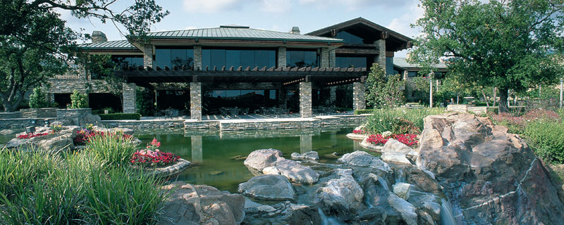
Coto de Caza (meaning game preserve in Spanish) is a census-designated place (CDP) and guard-gated private community in Orange County, California. The population was 13,057 at the 2000 census.
The CDP is a suburban planned community of about 4,000 homes, and one of Orange County’s oldest and most expensive master planned communities. The project began in 1968, when it was envisioned as a hunting lodge, now the Lodge at Coto de Caza, and the community was completed in 2003. For the 1984 Summer Olympics, the community served as host to the riding, running, shooting, and fencing portions of the modern pentathlon events. Around the town there are still undeveloped lots available for purchase. Currently there are two 18-hole golf courses, and two club houses, one considered the “old club” and the other the “new club.” The new club, the Coto De Caza Golf & Racquet Club, harbors the facilities of the two golf courses and adjacent ten tennis courts. The old club, located in the residential area known as “the Village,” was once home to tennis guru and teacher Vic Braden. The old club was also the home location for the Coto de Caza Youth Swim Team. The new club finished construction of the new Spa & Sports Club building in April 2008 that houses a new fitness center with state of the art StarTrac exercise equipment, a spa with many services, a snack bar with Starbuck’s coffee, and the Michael Chang tennis hall of fame and member lounge. The golf courses are both Robert Trent Jones Jr. design. The North course was rated the most difficult golf course in all of Orange County.
The community is the setting of the reality-based television show The Real Housewives of Orange County on Bravo.
Coto de Caza contains commercial endeavors, Lodge at Coto de Caza, The Coto de Caza Golf and Racquet Club, & The Coto de Caza General Store. Residents shop in Rancho Santa Margarita, Mission Viejo, Las Flores, or Ladera Ranch. Most students in Coto de Caza reside in the Capistrano Unified School District and attend Wagon Wheel Elementary, Tijeras Creek Elementary, Las Flores Middle School, Tesoro High School, and Santa Margarita Catholic High School (not part of Capistrano Unified). The majority of the community is tract housing, with collections of custom-built homes on the outskirts off the main streets. Coto de Caza is twenty minutes from the San Diego Freeway (Interstate 5) and five minutes from the Foothill Toll Road (State Route 241) to Irvine and then Riverside County.
While some residents believe that “Coto de Caza” means “Preserve of the Hunt” in Portuguese, this is erroneous. Actually, “Coto de Caza” is Spanish for “Hunt Reserve” and implies that the reserve is private.
Coto de Caza is located at 33°35′45″N 117°35′16″W / 33.59583°N 117.58778°W / 33.59583; -117.58778 (33.595925, -117.587665). According to the United States Census Bureau, the CDP has a total area of 7.9 square miles (20.5 km²), of which, 7.9 square miles (20.4 km²) of it is land and 0.04 square miles (0.1 km²) of it (0.38%) is water.
The Thomas F. Riley Wilderness Park, which is open to the general public except after rain, surrounds the community of Coto de Caza on its eastern, northern, and southern borders. The park is a Wildlife and Plant Sanctuary and is known for its biological diversity. It is known for its oak groves, sycamores, and two creeks. The park is home to mountain lions, that have been known to attack when provoked, without warning. It is nearly 500 acres (2.0 km2) in size. It features approximately 6 miles (9.7 km) of equestrian, hiking, and biking trails. Inside the nature center it houses an educational center for outdoor education for local schools and community groups. It also serves as an ecological preserve for the native endangered plant and animal species. It is maintained and paid for by Orange County Parks, and is administered by Park Rangers and maintenance staff.
Dove Canyon is a private residential community located in eastern Rancho Santa Margarita. It is a small enclave of approximately 1,200 homes and 5,000 residents. Included within the guard-gated entry is a Jack Nicklaus signature golf club, pool, tennis courts, a small child’s park, a wide field, a shopping center, and a reservoir. The majority of its residents are upper middle class residents of Orange County, and all of the homes in Dove Canyon are single-family residences.
It is located in the Southeastern most foothills of Orange County. Major roads include Dove Canyon/Bell Canyon and Sycamore Canyon. A horse trail starts at the waterfalls outside of the community and continues until the end of Sycamore Canyon. From there, hikers, horse riders, bikers, etc. can continue into Dove Canyon’s neighbor community, Coto de Caza
Foothill Ranch (FHR) was a census-designated place in Orange County, California, United States. The population was 10,899 at the 2000 census. Foothill Ranch was annexed into Lake Forest, California in 2000. Foothill Ranch is notable for such company headquarters as Oakley, Inc., Wet Seal, Kaiser Aluminum, and ProBoards. It is also the home of Saddleback Church.
Foothill Ranch is located at 33°41′19″N 117°39′51″W / 33.68861°N 117.66417°W / 33.68861; -117.66417. According to the United States Census Bureau, the CDP has a total area of 2.8 square miles (7.3 km²), all land.
As of the census of 2000, there were 10,899 people, 3,816 households, and 2,976 families residing in the CDP. The population density was 3,858.8 inhabitants per square mile (1,492.2/km²). There were 3,873 housing units at an average density of 1,371.2 per square mile (530.3/km²).
Irvine is an incorporated city in Orange County, California, United States. It is a planned city, mainly developed by the Irvine Company since the 1960s. Formally incorporated on December 28, 1971, the 66 square mile (171 km2) city has a population of 212,375 as of the 2010 census. However, the California Department of Finance estimates its 2011 population to be 219,156. It has annexed in the past an undeveloped area to the north, and has also annexed the former El Toro Marine Corps Air Station, most of which is planned to be converted into the Orange County Great Park.

A view of the Jamboree Center in Irvine, one of the first urban developments in the city.
The layout of Irvine was designed by Los Angeles architect William Pereira and Irvine Company employee Raymond Watson, and is nominally divided into townships called villages. The townships are separated by six-lane streets. Each township contains houses of similar design, along with commercial centers, religious institutions and schools. Commercial districts are checker-boarded in a periphery around the central townships.
Pereira originally envisioned a circular plan with numerous man-made lakes and the university in the center. When the Irvine Company refused to relinquish valuable farmland in the flat central region of the ranch for this plan, the University site was moved to the base of the southern coastal hills. The design that ended up being used was based on the shape of a necklace (with the villages strung along two parallel main streets, which terminate at University of California, Irvine (UCI), the “pendant”). Residential areas are now bordered by two commercial districts, the Irvine Business Complex to the West and the Irvine Spectrum to the East. Traces of the original circular design are still visible in the layout of the UCI campus and the two man-made lakes at the center of Woodbridge, one of the central villages.
Each of the villages was initially planned to have a distinct architectural theme.
Demographics
|


|
||||||||||||||||||||||||||||||||
Lake Forest was incorporated in 1991 before that the city was known as El Toro an unincorporated area of Orange County. Since becoming incorporated Lake Forest has expanded its boundaries to include Foothill Ranch and Portola Hills. Lake Forest is located in the heart of South Orange County- right by the two major North / South freeways the 5 and the 405 and as of Jan 1009 has a population of approximately 78,000. The city treasures its rich heritage but also welcomes new and future business and development. The city is a wonderful location for people to work as well as play and live. It has recently been ranked the 8th safest city for cities it´s size.
The area was originally called Rancho Canada De Los Alisos and Don Jose Serrano was the original owner through a Mexican Land Grant in 1846. The area was named El Toro after the bulls that were on Don Jose Serrano´s ranch. The land remained in the family for more than a hundred years. The family then met with financial issues and it had to be sold to private interests. In the 1900´s Dwight Whiting- an area resident planted 400 acres of eucalyptus trees helping solve California´s lumber shortage. After World War II the area began development of residential, commercial and industrial areas replacing acres of farmland. In 1960- Occidental Petroleum started a master planned community using the acres of eucalyptus trees and man- made lakes to accent the homes. This area is now known as the “Forest” area of Lake Forest. The local Marine Air Corps base provided the need for additional housing and supporting services ? this building formed the base for the Lake Forest that is currently being enjoyed.
The city offers a great mix of business, industrial and commercial office parks. The city is very business friendly not requiring a business permit to open and operate a business. There are research and development companies as well as technology, manufacturing and a great mix of retail. Large companies in the city are Oakley, Wet Seal, Del Taco corporate offices, Panasonic Avionics, Apria Healthcare, Black and Decker, Western Digital and Wonderware are all located throughout the industrial areas. The city encourages businesses to set up and maintain Lake Forest as their location to do business
The city has been great in revitalizing the retail areas. They recently completed the Arbors and Orchard shopping centers. The city modernized the median areas, bus stops and general feel of El Toro road from the freeway to Muirlands- they plan on moving onto to complete El Toro up to Jeronimo and to work on Rockfield between El Toro and Ridge Route, adding medians and beautifying the sidewalk areas.
Lake Forest is a series of tract homes that are surrounded by man-made lakes, numerous parks and schools. There are lake front homes as well as condominiums, horse property, luxury homes, mobile home parks and retirement communities, to meet all the needs of families of all stages of life.
The over 25 parks that dot Lake Forest offer a variety of playgrounds, pools, volleyball, basketball, baseball and soccer fields. Etnies Skatepark is a large draw for the skateboard enthusiasts. The city is looking to expand their park offerings with a large sports park near El Toro and Portola. They are in the works of developing a master plan for the area and acquiring the needed property- they are hoping it will encompass almost 60 acres upon completion. Another large recreation area is Whiting Ranch Regional Wilderness park which offers bike and hiking trails. It is a popular park that has its access in Lake Forest. The area parks offer free summer concerts. The best place to celebrate Lake Forest´s heritage is at Heritage Hill Historical park which houses all types of city sponsored programs for all age groups. There are two man-made lakes in the city- Lake Forest Beach and Tennis Club and the Sun and Sail Club feature tennis courts, gym, basketball courts, barbeque pits, volleyball courts, multiple swimming pools.
Lake Forest has an award winning school district- Saddleback schools there are also private elementary schools and trade and technical schools within the city. The high school within the city limits is El Toro High school The high school opened in 1973 and has won numerous awards. There are many universities within minutes of Lake Forest for expanded educational opportunities. University of California at Irvine, California State University at Fullerton, Chapman University, Concordia University, Saddleback and Irvine Valley Community Colleges are all places residents can attend and still be close to home.
El Toro was most well known for the Marine Corps Air Station Base which was located one mile from the city and affected many areas of the city with the flight paths. El Toro was considered to be a great place for the military. The base closed in 1999. After a prolonged fight with the powers that be that wanted to house a commercial airport at the site the base / airport is now officially shuttered. The new plans for the base are a Great Park which really makes Lake Forest a great place to be.
Ladera Ranch has been a sought after community since its debut as one of the nation’s most innovative master planned communities in 1999. Full of amenities such as parks, pools, villages clubs and more throughout the community, it’s a place where people of all ages find something to be a part of. Whether it’s a Summer Concert, Movies in the park, Mommy and Me, or a huge Fourth of July celebration, its here in Ladera Ranch.
Ladera Ranch offers five Villages clubs- each with its own unique character and location- great for celebrating gatherings, recreation and life’s ‘ memories. Take a dip in one of the many swimming pools or enjoy the skate park around the corner.
The 4,000 acre community of Ladera Ranch is surrounded by 1,600 acres of natural open space, offering residents the beauty of nature – outside their door. There are 7 trails ranging from the rug-ged Ladera Ranch Trail to the casual four-mile trail of the Sienna Botanica. One can also connect to the Country Regional Trail System as well.
With it’s 16 parks ranging from Cox Sports park, with soccer fields, baseball fields to Wagsdale Park- which features a large dog park and a small dog park.
Ladera Ranch also has its own community intranet www.LaderaLife.com where neighbors can connect with one another to share their interests, join and form clubs and find out about the lastest happenings in Ladera Ranch. Quality of education is one of the core values of Ladera Ranch- we have three elementary schools, one middle school and there are two high schools that service the area of Ladera Ranch. For more information about the schools visitwww.capousd.org. In addition their are local preschools and private schools.
Shopping you say… Ladera offers great restaurants, grocery, coffee houses, Kohls department store, vet, Medical, Dentists and more. For more information about the local businesses, please visit the local Ladera Chamber of Commerce website.
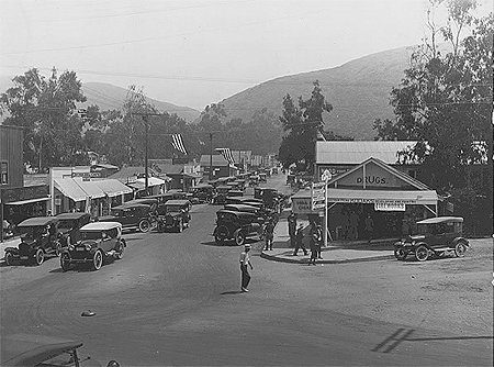
Laguna Beach is the second oldest city in Orange County, second to Anaheim.
Settlers arriving after the American Civil War found scarce amounts of land available for homesteading, and one such tract, known then simply as “the public lands” was the coastal strip from Laguna Canyon to Three Arch Bay. During the 1870s, a small community named Arch Beach had been started at the mouth of Bluebird Canyon. By the early 1880s most of the land around its small Post Office and general store had been subdivided. At about the time that Orange County separated from Los Angeles County and became independent in 1889, the community was caught in an economic downturn.
When the economy renewed itself, the decision was made to relocate the town to the mouth of Laguna Canyon. This was possible because a dispute with the Irvine ranch over the public right to traverse Laguna Canyon had been resolved in the courts, allowing an additional means of access to the coast. The streets were laid out in a grid plan despite the location’s hilly nature, which has resulted in some streets having extremely steep inclines.
By 1900 Laguna Beach was occupied by five families of homesteaders struggling to farm land. They soon found an additional source of income by renting sections of the beaches to farmers from Tustin, Santa Ana, Fullerton, Riverside, and other inland communities who were eager to escape the summer heat. Thus began the tourist industry which is still a mainstay of the local economy. Pioneer days in Laguna Beach and its growth from a few scattered buildings to one of the most beautiful seaside resorts in the West as well as a famous California art colony was vividly recounted by J. S. Thurston (born in 1868), a son of one of the community’s original settlers, in Laguna Beach of Early Days(The Press of Murray & Gee, Culver City, California, 1947).
In the early 1920s the area was discovered by a group of landscape painters who laid the foundation of the art community which is still thriving to this day. Subsequently, various groups have “discovered” Laguna Beach and added incrementally to the town’s diversity. Many wealthy and progressive people have made Laguna Beach their home and added to the local culture. Gerry Max, in recording the life of one of the community’s most famous early members, travel writer Richard Halliburton (1900–1939), has called Laguna a “weary rover’s dream,” and in Horizon Chasers offers a sense of Laguna Beach in the 1920s and 1930s. Hildegarde Hawthorne, granddaughter of the novelist Nathaniel Hawthorne, described Laguna “as a child of that deathless search, particularly by persons who devote their lives to painting or writing, or for some place where beauty and cheapness and a trifle of remoteness hobnob together in a delightful companionship.”. Halliburton himself marveled at the “sensational vistas” and “the peaceful valley on the one side (of the home called Hangover House which he had built on the ridge) and the full sweep of the ocean on the other.”
The region was originally known to the Spanish as “La Cañada de Las Lagunas” which means “The Canyon of the Small Lakes”, in reference to two lakes found near the head of Laguna Canyon. However, in confusion with the word “Lagoon”, Laguna Beach was nearly misnamed “Lagoona” by the State of California. While it was still an unincorporated community, the Postmaster, Nicholas Isch, journeyed to Sacramento to rectify the mistake, and the original Spanish spelling was retained.
Laguna Beach was incorporated as a General Law City in 1927 and has experienced a slow but steady population growth since that time. Laguna Beach was the southern California epicenter of ‘alternative’ culture in the late 1960s and early 1970s. In early 1967, John Griggs and other founding members of the Brotherhood of Eternal Love relocated from Modjeska Canyon to the Woodland Drive neighborhood of Laguna Beach, which they later re-christened ‘Dodge City’. Timothy Leary lived for several months with the Brotherhood until his December 26, 1968 arrest for possession of marijuana, near the intersection of Woodland Drive and Roosevelt Lane.
Laguna Beach has a warm Mediterranean climate with abundant sunshine all year. Daytime temperature averages range from 67°F in January to 79°F in July. Mean annual precipitation is relatively low – 13.56 inches. Water temperatures are some of the warmest on the southern California coast and range from about 60°F in February to 72°F in August; however in early to mid September water temperatures often range from 73°F-75°F.
According to the United States Census Bureau, the city has a total area of 25.2 km2 (9.7 sq mi). 22.9 km2 (8.8 sq mi) of it is land and 2.3 km2 (0.89 sq mi) of it is water. The total area is 9.24% water. It is bordered by the Pacific Ocean on the southwest, Crystal Cove State Park on the northwest, Laguna Woods on the northeast, Aliso Viejo and Laguna Niguel on the east, and Dana Point on the southeast.
The land in and around Laguna Beach rises quickly from the shoreline into the hills and canyons of the San Joaquin Hills. The town’s highest point, at an elevation of 1,007 feet (307 m), is Temple Hill in the Top of the World neighborhood.[8] Because of its hilly topography and surrounding parklands, there are few roads into or out of town; only the Coast Highway connecting to Newport Beach to the northwest and to Dana Point to the south, and State Route 133 crossing the hills in a northeastern direction through Laguna Canyon. Parts of Laguna Beach border the Aliso/Wood Canyons Regional Park. In 1979, Laguna Beach was described as “a paradise, an inexhaustible source of inspiration” by artist Marco Sassone, one of the many artists who made the “idyllic” town home since the 1920s.
As of the census of 2000, there were 23,727 people, 11,511 households, and 5,778 families residing in the city. The population density was 1,035.1 /km2 (3,000 /sq mi). There were 12,965 housing units at an average density of 565.6 /km2 (1,000 /sq mi). The racial makeup of the city was 91.99% White, 0.80% African American, 0.36% Native American, 2.08% Asian, 0.08% Pacific Islander, 2.21% from other races, and 2.47% from two or more races. Hispanic or Latino of any race were 6.62% of the population.
There were 11,511 households out of which 18.5% had children under the age of 18 living with them, 40.9% were married couples living together, 6.3% had a female householder with no husband present, and 49.8% were non-families. 36.7% of all households were made up of individuals and 8.1% had someone living alone who was 65 years of age or older. The average household size was 2.05 and the average family size was 2.69.
In the city the population was spread out with 15.8% under the age of 18, 4.2% from 18 to 24, 32.9% from 25 to 44, 33.9% from 45 to 64, and 13.3% who were 65 years of age or older. The median age was 43 years. For every 100 females there were 103.7 males. For every 100 females age 18 and over, there were 104.0 males.
According to a 2007 estimate, the median income for a household in the city was $90,017, and the median income for a family was $146,562. Males had a median income of $66,221 versus $46,138 for females. The per capita income for the city was $58,732. About 2.8% of families and 5.1% of the population were below the poverty line, including 4.7% of those under age 18 and 4.3% of those age 65 or over.
Do you have a question? Perhaps your looking to buy or sell a home. Reach out to us, we would love to hear from you.
Phone. (949) 292-1393Copyright © 2013 Coast to Canyon Real Estate.
All rights reserved.
Agent Private Page
![]()
![]()
![]()
